
Computer Vision
Enabling computers and devices to understand what they see.

Tool
Satellite Imagery Labeling Tool
This is a lightweight web-interface for creating and sharing vector annotations over satellite/aerial imagery scenes.
Microsoft Research Blog
Research Focus: Week of October 24, 2022
Welcome to Research Focus, a new series of blog posts that highlights notable publications, events, code/datasets, new hires and other milestones from across the research community at Microsoft. Microsoft is thrilled to announce the 2022…
Microsoft Research Blog
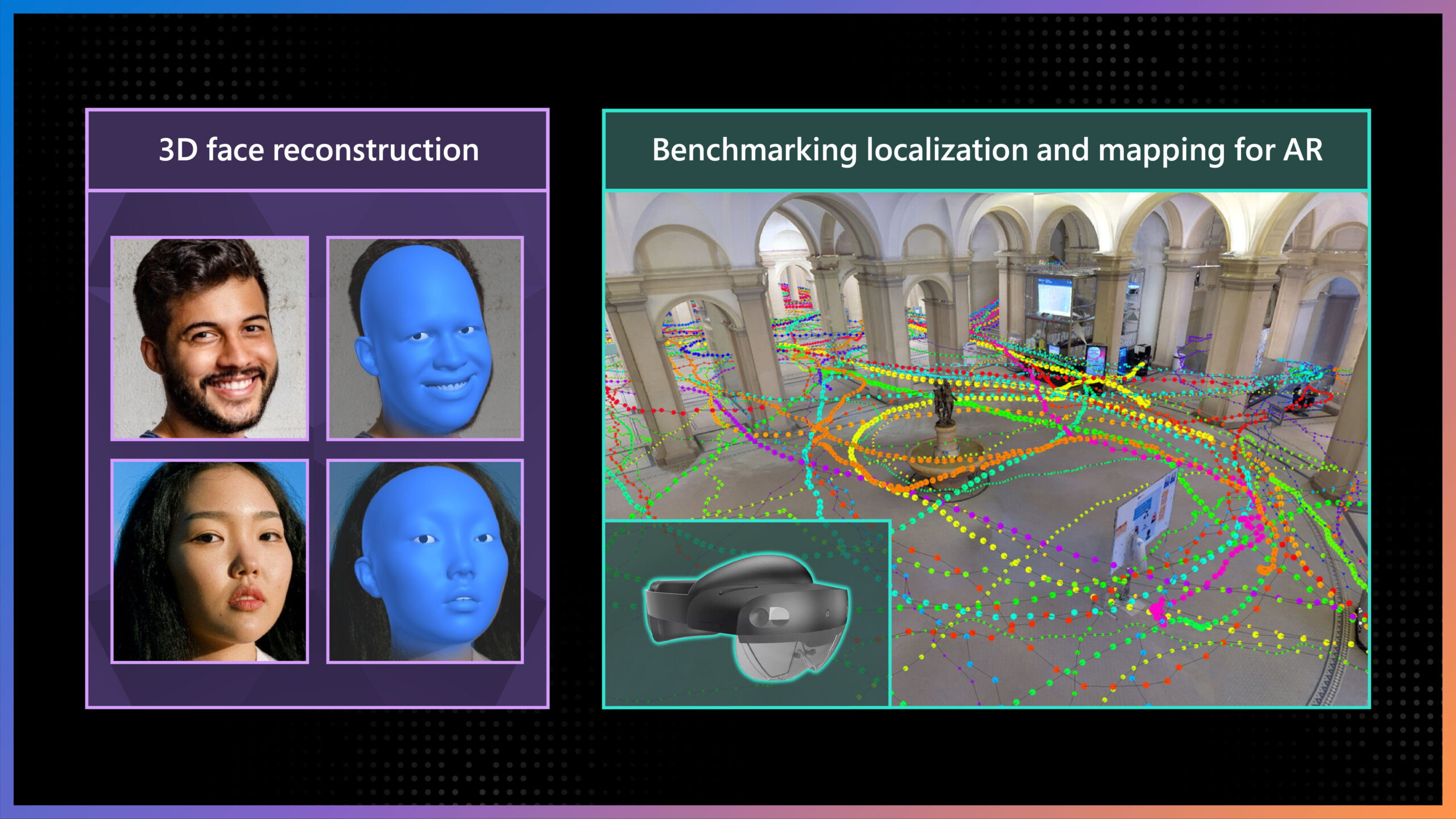
ECCV 2022 highlights: Advancing the foundations of mixed reality
Computer vision is one of the most remarkable developments to emerge from the field of computer science. It’s among the most rapidly growing areas in the technology landscape and has the potential to significantly impact…