uGAP: A Unified Geospatial AI Platform for African Geographic Data
- Ian Ocholla, University of Cape Town; Gilles Quentin Hacheme, Microsoft; Stephanie Nyairo, Microsoft
- MSR Africa Seminar Series
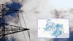
Timely spatial data is critical to addressing Africa’s most pressing challenges, yet much of it remains fragmented and inaccessible. This fragmentation drains research resources and forces a reliance on external models that overlook local vulnerabilities. uGAP directly solves this problem: by unifying 100+ African datasets with a Python SDK, it fuses data discovery, processing, and model training into a single, seamless workflow. By eliminating these technical bottlenecks, uGAP empowers local researchers to turn raw data into targeted, community-relevant resilience policies.
-
-

-

Gilles Quentin Hacheme
Sr. Applied Research Scientist
-

Stephanie Nyairo
Senior Product Designer
-
-


Watch Next
-
-
-
-

Sparrow Studio Tutorial - Ep 1. - What is Sparrow Studio?
- Carl Chalmers,
- Bruno Demuro Segundo,
- Zhongqi Miao
-
-
Network transceiver insertion
- Elliott Hogg,
- Andromachi Chatzieleftheriou
-
Chopstick-Inspired Non-Prehensile Manipulation for Datacenter Automation
- Andromachi Chatzieleftheriou,
- Harshit Khurana,
- Elliott Hogg
-
-
-